WARNING: This trail crosses customary land. Please respect these places and their traditions (see the code of good practice).
ROUTE DESCRIPTION
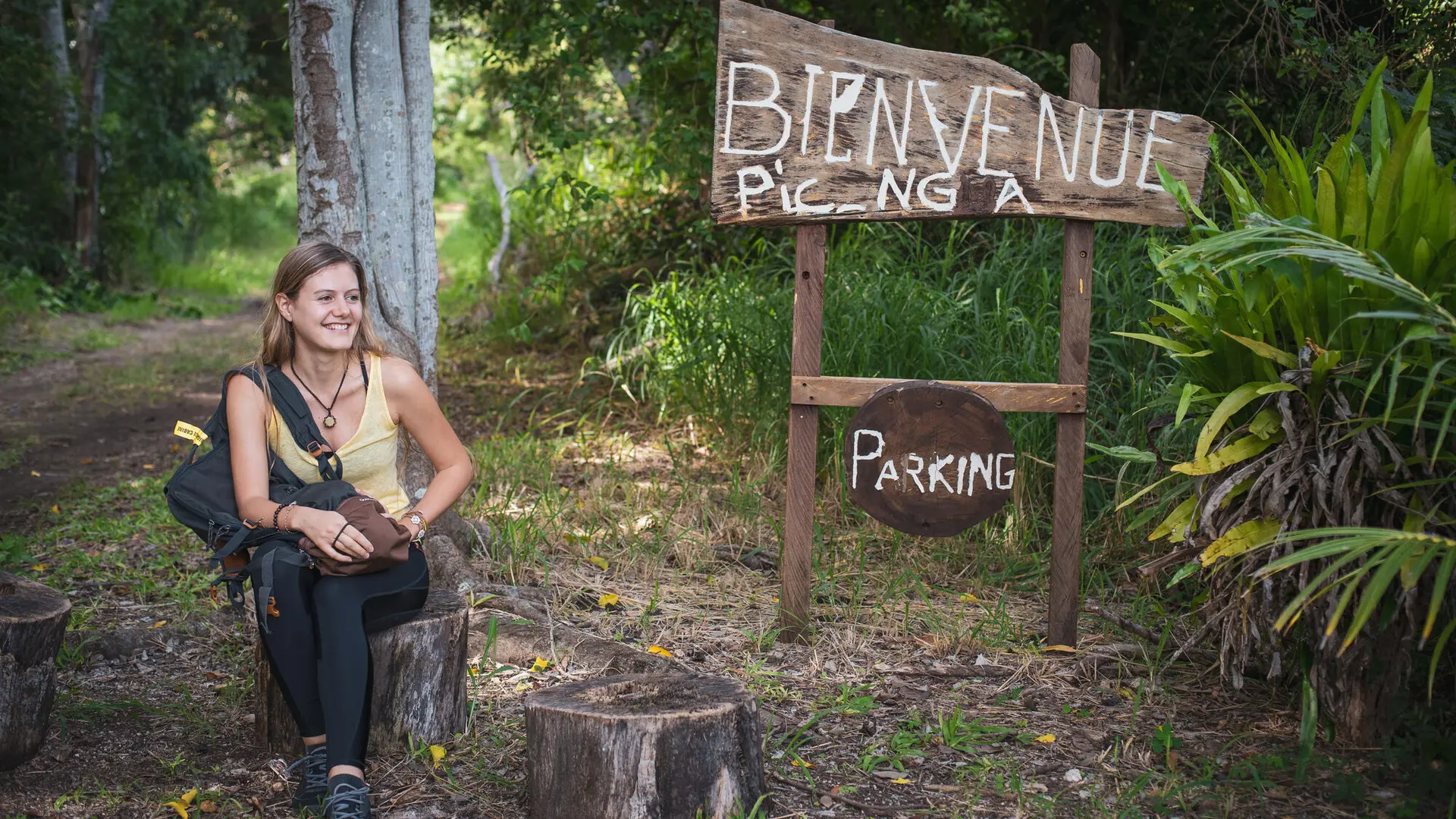
From the car park (751521 – 7,492,475; elev. 3 m): located in a small clearing beside the road (R.M.6). Head north-east along the shaded track. Bicycle parking is available. At the entrance sign, take the trail entering the denser dry forest.
1 – Welcome area (751742 – 7,492,623; elev. 3 m):
[When entering customary land, before using the trail, you may choose to leave a coin — of any value — as a sign of respect and greeting to the land and its people.]
Follow the path running to the left of a creek that is often dry. Shaded by dense vegetation, the walk is calm and pleasant. Cross a small culvert and continue to the next crossing.
2 – Gabion area (751913 – 7,492,740; elev. 8 m):
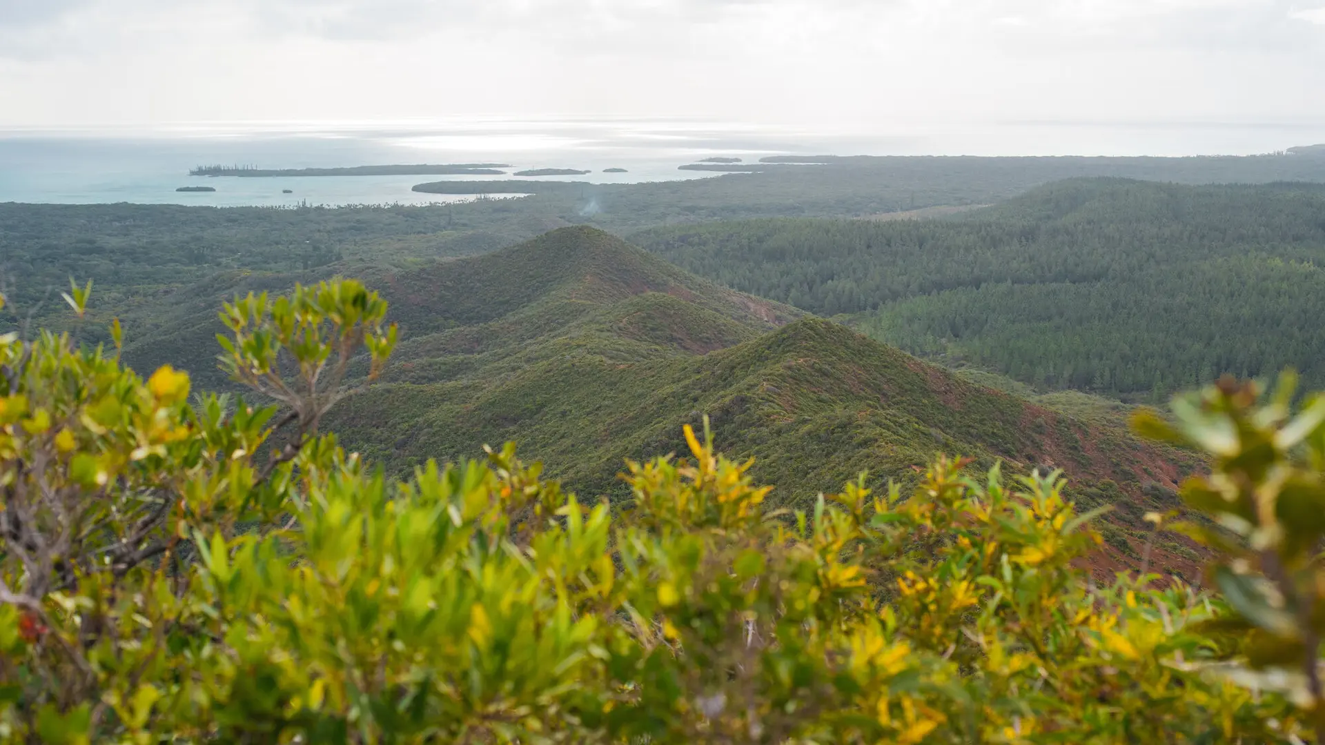
Carefully cross the creek (often dry) using the installed gabions. The trail gradually steepens, turning progressively eastwards. It leaves the forest and climbs through rocky ground along a small secondary ridge.
3 – Switchbacks (752397 – 7,492,661; elev. 58 m):
The ascent becomes quite steep. Built steps and switchbacks make the climb easier. A bench set on a right-hand bend offers a welcome rest. Continue to a saddle.
4 – Junction (752510 – 7,492,445; elev. 124 m):
Turn right to reach the Kou-Djë lookout, or left to head directly to the summit of Pic N’Ga.
5 – Lookout (752384 – 7,492,358; elev. 145 m):
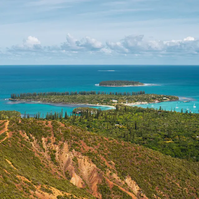
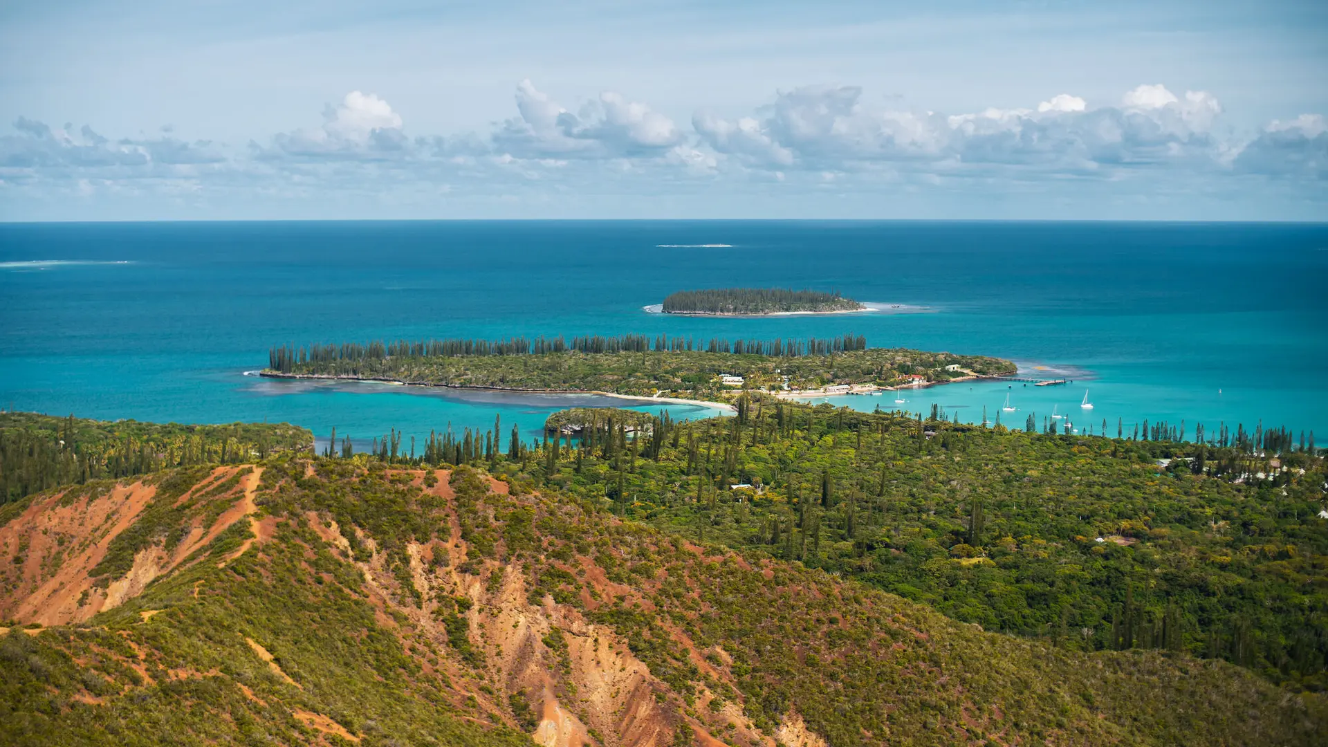
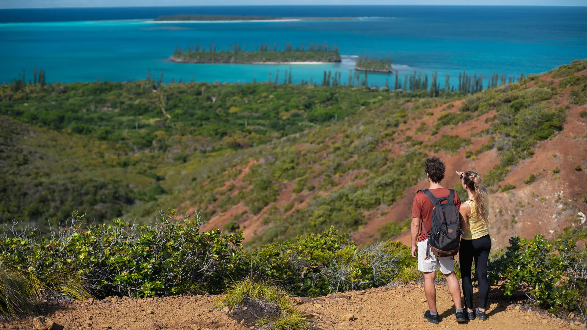
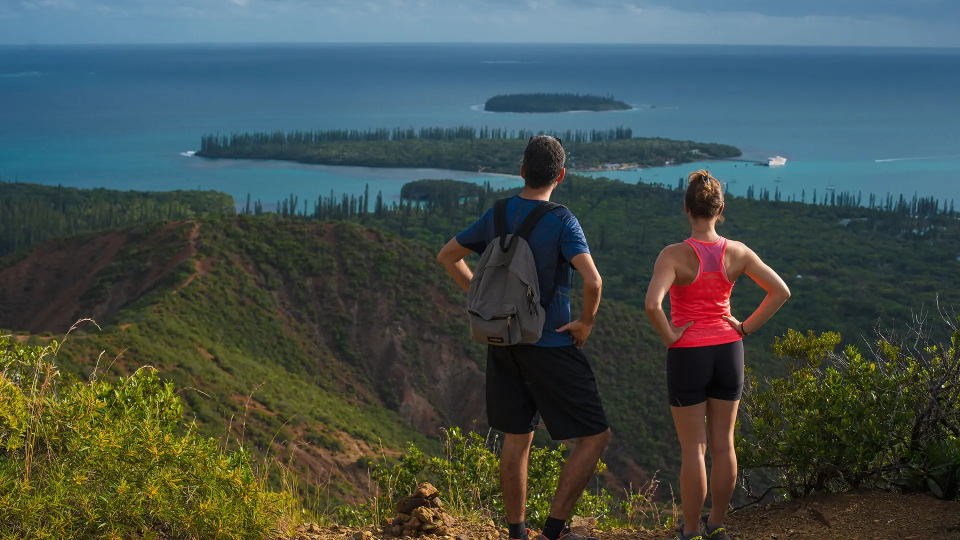
Return to point no. 4. Pass the helicopter landing zone (DZ). Follow the ridge climbing north. The trail skirts the shoulder (elev. 247 m) to the west, then north, before reaching an open promontory topped by a cross. From here, the island and surrounding lagoons unfold below.
6 – Cross (752962 – 7,492,794; elev. 247 m):
Return to the trail and continue towards the highest point, crowned with columnar pines that provide some shade.
7 – Summit (753001 – 7,492,811; elev. 259 m):
[Bench, information panel.]
(An unmarked, undeveloped trail leads west towards Pic Meunier.) Follow the ridgeline eastwards.
8 – Panoramic viewpoint (753139 – 7,492,748; elev. 257 m):
Reach a lookout offering sweeping views to the east (Vao, Upi Bay, Oro Peninsula and the vast turquoise lagoon).
Return via the same route or via the Pic Meunier trail (unmarked and undeveloped).
This trail was developed by Province Sud, in partnership with the Kaa Bugnyi association and Kanopia.
© Texts: Jean Francis Clair
FFRandonnée® grading
Effort: (IBP 38) 2 fairly easy (blue)
Technical difficulty: 1 easy (green)
Risk: 1 low (green)
Overall rating: 2 fairly easy (blue)
Note: As the trail is very rocky, wearing a good pair of sports or hiking shoes is strongly recommended.
Read more